What is Orthomosaic Imaging? What Is It Used For?
Orthomosaic Imaging is a technique used that involves stitching together multiple overlapping aerial or satellite images of a given area to create a single high-resolution, geo referenced Image.
The process involves first capturing multiple images of an area from a drone or satellite, typically using a specialized camera that can capture high resolution images with GPS coordinates. These images are then processed using specialized software to create a seamless geo referenced mosaic of the area.
Orthomosaic imaging for general mapping is particularly useful for creating general maps of large areas such as farms, construction sites, and urban environments to help visualize a large area while still maintaining resolution to zoom in closely. The resulting Images can be used for a variety of applications including, inspection, event planning, property management, and much more.
Generalized Orthomosaic maps can also be combined with other types of data, such as elevation data, to create 3D models of an area. This can provide additional insights into the topography and structure of the land, making it a powerful visualization tool.
Orthomosaic Imaging has a wide range of applications and can benefit several industries.
Here are a few examples,
Agriculture: Orthomosaic images can be used to monitor crop health, identify areas of stress, and track changes in vegetation over time. This can help farmers optimize crop yields and reduce costs.
Construction: Create 3D models of construction sites, track inventory, supplies, materials and identify potential hazards or concerns. This can help improve project management and reduce costs.
Environmental Management: Monitor natural resources and wildlife habitats. This includes tracking changes in land use, wetlands and other sensitive ecosystems, and monitoring wildlife populations. Monitor environmental changes such as deforestation, erosion, and land degradation.
Disaster Management: Assess the extent of damage caused by natural disasters such as hurricanes, floods, and wildfires. This can help emergency responders prioritize their efforts and allocate resources more efficiently.
Solar farms: Site Planning and Design: Create detailed images of the solar farm site, which can help with site planning and design. This includes determining the optimal placement of solar panels, access roads, and other infrastructure. Site assessment can provide detailed information about the terrain and vegetation in and around the solar farm site. This can help assess the feasibility of the project and identify any potential obstacles or risks. Inspect solar panels for damage, defects, and other issues to identify problems quickly and reduce maintenance costs.
Mining: Monitoring land usage, identifying potential mineral deposits, and assessing the impact of mining operations on the environment.
Real estate: Create accurate, complete lot images that provide a detailed representation of the property so clients can inspect the entire property with one high resolution image. This gives clients the ability to zoom in on the photo and discern centimeter marks on a tape measure. This is a great tool for realtors, buyers, and sellers because it gives all parties up to date visual evidence of the current condition of everything on the property.
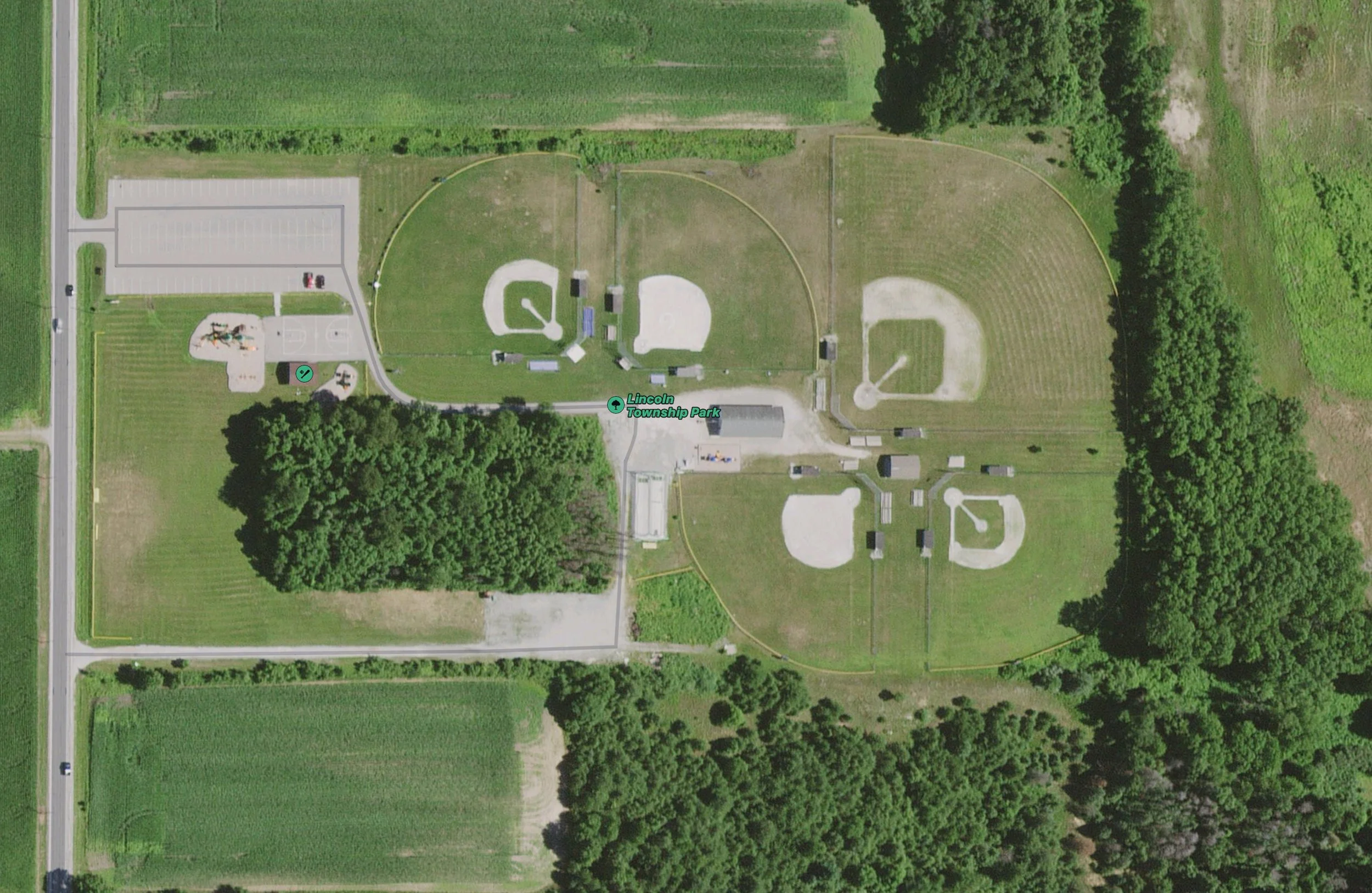
Google maps latest satellite image dated 4/22/2017
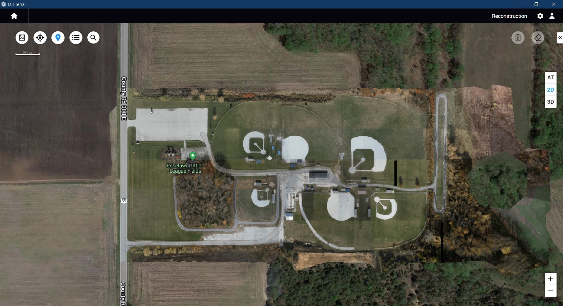
Orthomosaic captured with M300 and P1 10/27/2023


